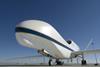
As the US East Coast bunkers down for a hurricane hammering, we look at aircraft used by US Air Force Special Operations and the National Oceanographic and Atmospheric Administration to fly directly into hurricanes to take the critical measurements that help predict where a storm is heading.

The first time the US Army Air Corps flew an aircraft into a hurricane was in 1943. U-boat activity had forced US navy ships to go radio silent for much of the war, depriving US weather forecasters of a highly valuable source of weather data. Around that time, a big storm named Hurricane Surprise was moving into Texas. A couple of army air corps pilots got into a bet about whether they could fly a T-6 into the storm. One of the pilots took the bet, boarded a T-6 with a navigation officer and flew straight into the hurricane. He reached the eye and then flew back out and landed safely. The weather officer on the base asked the pilot to take him into the storm, so they flew back into it that day. Thus, the hurricane weather reconnaissance mission was born.

1. Northrop Grumman Global Hawk

NASA’s Global Hawk has a fair amount of experience in this domain, having recently completed the NASA/NOAA Sensing Hazards with Operational Unmanned Technology – or SHOUT – programme at the end of September. This involved using the UAV to see if weather model forecasts for events such as tropical storms, winter storms and major floods could be improved. Global Hawk was operated from NASA’s Wallops Flight Facility in Virginia, from which it flew over the Atlantic ocean basin and collected data on temperature, moisture, wind speed and direction. The real-time data will now go into US National Weather Service forecast models at the National Hurricane Center.

global hawk c nasa

NASA's Global Hawk

NASA

2. Lockheed WC-121N Willy Victor

Operated by the US Navy from 1955-1975, the WC-121Ns tracked hurricane movement with APS-20 S-Band airborne early warning radars. The navy’s WV-4 squadron – hence, the aircraft’s Willy Victor nickname – first penetrated a storm with Hurricane Diane in 1955. Derived from the Lockheed Constellation, the WC-121N’s 20,000ft ceiling allowed navy weather forecasters to sample data from higher altitudes.

Feature HurHunters WV-3 c US Navy

Willy Victor

US Navy

3. Lockheed WP-3D

Special versions of Lockheed’s P-3 Orion have been monitoring hurricanes since a US Navy WP-3A entered Hurricane Edith on a low-level night mission in 1971. But two WP-3Ds operated by the NOAA represent two of the most sophisticated storm data collectors in the world. Nicknamed “Miss Piggy” and “Kermit”, the WP-3Ds are flying meteorological laboratories equipped with 15 systems used to collect data about hurricanes.

NOAA WP-3D Orions 640

Miss Piggy and Kermit

NOAA

4. Gulfstream GIV-SP

Flying over the top of a hurricane can yield a lot of data about where the storm is going. That’s why the NOAA acquired the Gulfstream GIV-SP in 1996. The large cabin business jet, which NOAA nicknames “Gonzo”, is capable of rapidly climbing to 41,000ft after take-off, then rising to 45,000ft as fuel weight is shed during cruise. From that altitude, a special modification allows the GIV-SP to dispense small dropsondes from thousands of feet above the storm. As the measuring devices fall through the atmosphere, they collect information about pressure, temperature, humidity and GPS-derived data about wind direction and wind speed.

NOAA Gulfstream IV

Gonzo

NOAA

5. Raytheon Coyote

The NOAA claims that the Raytheon Coyote was the first unmanned aircraft to be deployed directly inside a hurricane from one of the administration’s hurricane-hunting aircraft. It was launched from a chute in the belly of the P-3 Orion into Hurricane Edouard in 2014 for the first time, to collect weather data, including temperature, pressure and wind observations, at altitudes below 3,000 feet, where manned aircraft cannot safely fly.

Coyote - credit Raytheon 640

Coyote

Raytheon

6. Lockheed Martin WC-130J

Five different models of the Lockheed C-130 Hercules have prowled through hurricanes and typhoons since 1962 but the latest, and by far the most capable, is the WC-130J Weatherbird. Ten WC-130Js based at Keesler AFB play a key role in storm monitoring and forecasting. Equipped with a wing-mounted sensor called the ProSensing stepped-frequency microwave radiometer – “smurf” – the WC-130J measures surface wind speed and rain rate by detecting microwave radiation emitted by sea foam. It’s a more accurate method than extrapolating surface wind speeds from measurements taken at the altitude flown by the aircraft.

WC-130J c USAF 640

WC-130J Weatherbird

USAF

7. Lockheed P2V Neptune

In the early days of hurricane reconnaissance, air crews preferred the redundancy of four-engined aircraft, so the adoption of the twin-engined P2V required some getting used to. Nonetheless, the maritime patrol platform adapted well to the mission. The P2V, however, owns the tragic distinction of being the only weather reconnaissance aircraft lost inside a hurricane. The aircraft was lost in 1955 during a mission to penetrate Hurricane Janet and never found, despite an intensive search. Speculation has focused on the decision to bring along a newspaper reporter for the mission, who bumped a crew member assigned to monitor the aircraft’s altitude on its low-flying mission.

P2V-5 NAS Jacksonville 1952

P2V-5; sadly not the hurricane-chasing version

US Naval Air Station Jacksonville

8. Aerosonde

Textron Unmanned Systems’ Aerosonde is the perfect example of why UAVs are used for hurricane tracking – they can be thrown into the eye of the storm with no risk to crew, and are ultimately disposable. In 2005, the NOAA and NASA flew the UAV into tropical storm Ophelia, which they claimed was the first time an autonomous vehicle was flown into the core of a mature tropical system. Then, in 2007, the small, long-endurance UAV was intentionally ditched into the Atlantic Ocean off North Carolina after taking a unique close-up look at the category 1 Hurricane Noel for the NOAA during a 17.5h mission.

Aerosonde 4.7 - AAI

Aerosonde

Textron

9. And, coming soon...

Taking an even more elemental approach to hurricane monitoring by UAV, Professor Kamran Mohseni of the University of Florida’s department of mechanical and aerospace engineering proposes going small, cheap and disposable – flying multiple aircraft like this one, fitted with inexpensive sensors, through and into a storm, maybe recovering them and maybe not. This “aggregate” method of data collection could be adapted to many tasks, such as wildlife management and precision agriculture.

UofFlorida UAV

That's F for Florida – orange, too

University of Florida

Source: FlightGlobal.com