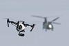
Advances in technology, improved designs and imaginative applications have led small unmanned air systems – frequently referred to by regulators and users by the popular term “drones” – to be increasingly seen as ready for widespread civil use. But while they are generally regarded, from a capability point of view, as having long since moved past the stage of merely having the potential to be economically useful, there remain serious questions about safety. That is, unless UAVs can share ordinary airspace with crewed aircraft, their use will remain highly restricted.

Ultimately, the objective is to achieve safe, regular operations by either fully integrating UAVs into existing air traffic management systems, or to create a UAV-specific ATM system that would allow them to operate in parallel with existing air traffic. Critically, what must be achieved is a system that allows beyond-line-of-sight (BLOS) operations that do not affect other aircraft.

“As we move to more complex and valuable drone operations, they will inevitably be beyond-line-of-sight,” Andy Sage, drones lead at UK air traffic management provider NATS, tells FlightGlobal. Citing as an example one aspirational use of drones, he add: “There is no point in carrying blood from A to B if you still have to be able to see the drone. Once we look to those types of operations, we simply do not see the airspace as being unsegregated to support these types of operations.”

Drone Chinook - Jed Leicester/REX/Shutterstock

Jed Leicester/REX/Shutterstock

This future way of controlling UAVs in national airspace is referred to as U-Space or unmanned/unified traffic management (UTM). This will either be by having their own separate corridors to fly in, or by flying alongside manned counterparts while feeding into an ATM system.

Sage adds that the airspace will become very complex, and it will not always be possible to determine in advance where a UAV has to be, so more last-minute operations will have to be accounted for and made possible. “This is why we have advocated the idea of UTM being ‘unified traffic management’, because you cannot simply have a different management system for every type of user,” he says. “Be they manned or unmanned, they are sharing the same airspace, and we see this as a continuum of that.”

NASA has long been the leader in developing such systems, introducing its UTM concept many years before other agencies even began to consider that UAVs would eventually require air traffic control. Alongside the US Federal Aviation Administration, NASA is exploring the necessary technologies to incorporate low-level flying UAVs into a controlled system, in order to safely enable operations.

The NASA plan is to achieve four technology capability level (TCL) milestones, each of which builds on the previous one in terms of the level of risk involved. TCL1 field testing was completed in August 2015, and included assessment of potential operations for agriculture, firefighting and infrastructure monitoring, and focused on geofencing, altitude rules, and scheduling of vehicle trajectories. TCL2, completed in October 2016, looked at BLOS operations in areas with a low population density.

TCL3 will be the next and penultimate phase, and is due to begin this spring. This phase will test safe spacing over semi-populated areas between co-operative drones – which transmit their location themselves – and non-cooperative drones, whose locations must be observed and tracked by the external system.

TCL4 will be the last stage, which will look at more populated urban areas that could facilitate news gathering and package delivery operations. Dates for this TCL are unconfirmed, but NASA says it will also explore technologies that could manage large-scale operations during this phase.

NASA and the FAA are not the only players. As revealed earlier this year, Amazon, Boeing, GE and Google have plans to work on a private UTM system, separate from but parallel to NASA’s ongoing work. Testing is understood to be scheduled to begin in the coming months.

This private UTM effort is intended to manage low-level swarm flights, with individual UAVs avoiding each other by using cellular and web applications. The system envisaged is localised, so that each element of the UTM is applicable only to a user’s geographical area rather than having to factor in the whole of US airspace. Using off-the-shelf technology, the project will be funded by the companies to speed up development, in the hope of accelerating the commercial use of applications such as parcel delivery.

While NASA pioneered the concept of UTM, it is not the only agency looking at this development. Civil aviation authorities and private industry are also looking at how they can manage these types of operations in Europe. In March 2018, Swiss air navigation provider Skyguide and California-based AirMap, which develops airspace management platforms for small unmanned systems, said they would jointly develop a European national UAV traffic management system. The team claims its will be the first national deployment of U-Space, the term used to refer to a European Commission initiative to develop a digital structure for UAV traffic management.

Kicking off in June, the project will see the team integrate AirMap’s UTM system into Skyguide’s existing infrastructure, introducing automated flight authorisation under a pilot phase. A full UTM system is expected to be rolled out in 2019.

The AirMap system has already been deployed in Switzerland, as well as Japan, New Zealand and the US. It can offer up-to-date airspace information, the company says, as well as airspace rules for more than 20 countries.

“After a year of successful collaboration with AirMap, we expect that the AirMap UTM platform meets the highest standards required for a Swiss U-space,” says Skyguide chief executive Klaus Meier. “We’re looking forward to bringing U-Space capabilities to Switzerland, and we are excited to drive this innovation together with AirMap.”

The Swiss system will cover all categories of UAVs and mission types, and will include elements such as registration for both the users and the aircraft, geofencing and instant airspace access authorisation, real-time traffic alerts for pilots and live drone telemetry for airspace managers, and communication between pilots and airspace controllers.

There are a number of UAV companies based in Switzerland – UMS Skeldar and senseFly both have bases there, for example – and Skyguide claims that the country is seeing the introduction of UAVs as a potential boost for its economy, having noted that since 2013 UAV flight requests to the navigation provider have increased tenfold.

This new partnership leads on from a 2017 U-Space trial that took place in Geneva, which the team claims was the first live demonstration of this type of capability in Europe. Alongside SITAOnAir, AirMap and Skyguide demonstrated how registration, identification, geofencing and flight authorisations for UAVs could all come together. Live missions were flown with senseFly UAVs and PX4 autopilots.

In the UK, NATS is following a similar path to Skyguide in teaming with industry. In March 2018 NATS signed a long-term agreement with Altitude Angels to develop a UTM system that will complement a new “Drone Bill” that is expected to be proposed by the government later this year.

This is building on work NATS had already carried out with Altitude Angel in this area, which resulted in the development of the Drone Assist application that allows users to voluntarily register their aircraft and flight plans; some 50,000 users have signed up to date, Sage says. He adds that NATS wants to safely incorporate UAVs into operations on a day-to-day basis, allowing users to log flight plans and be able to view the activity of other airspace users, just as is the case with manned aviation.

“What we are also seeking to create is the means by which drone operators can access airspace and start to build more complex drone operations and safety cases moving forward within a clear UK framework,” Sage says.

The UK government is also expected to introduce no-fly zones as part of its strategy, which are likely to be existing danger zones, or transponder-mandatory zones around an airport. NATS and Altitude Angel are focusing on those at present because they pose the most risk.

Sage notes that the UK is taking a more measured approach to the integration of UAVs into airspace than other nations, which was evident from the early stages of planning, and has not resulted in a proliferation of no-fly zones as is the case elsewhere. “I think the UK community is doing a good job of embracing this,” Sage notes. “Everybody we speak to sees the potential value, but not at all costs. It has to be safely integrated into the existing airspace.

“While today most people are using them at visual line-of-sight and at low level, I think the safety risk can be managed, and the Drone Bill will help that enormously.”

He adds that the first phase of the introduction of UAVs into airspace has effectively come to an end, one that was focused on small aircraft and consumer applications, and it is now moving towards commercial BLOS operations.

“The UK has done more than most states to manage and control that risk and ensure that everyone can enjoy using drones while being responsible,” he says.

Sage claims that for the industry to reach its full potential, the airspace will ultimately have to be open and segregated, in order to offer the same flexibility to UAV users as is provide to other types of aviation.

There will inevitably be some regular operations such as rail network monitoring that will benefit from having dedicated corridors to fly UAVs in, however, and in the early stages they might be required for a range of operations to build up trust. “We certainly don’t think they [the corridors] are sustainable in the long-term, and we are focused on building solutions that will allow for a shared and open use of the airspace where they can,” he adds.

The general aviation segment is already benefiting from the technology and concepts that will ultimately roll into this UTM system, such as a recently launched airspace user portal. This portal makes it possible to digitally log flight requests up to an hour before flying, rather than having to rely on traditional, lengthy methods.

“We have worked with the user community and the CAA to effectively automate those processes, using the technology afforded to us by Altitude Angel that allows us to deal with a much greater workload, to provide a much quicker response and access to that airspace,” he says.

“Because we can deal with it much more efficiently now, it means we can potentially lower the weight threshold at which users have to follow that process, and we can provide greater access to lower level airspace where we are able to do so.”

Source: FlightGlobal.com