


Andrew Doyle/SAMARA
Lufthansa is making final preparations towards clearing its flight crews to use a global positioning system (GPS)-based landing approach system at Samara International Airport in Russia.
The technique has been under trial at Lufthansa's main hubs in Frankfurt and Munich for several months but Samara will be the first location where the system will be used on an operational basis, allowing non-precision Category I approaches to be flown independent of ground aids. GPS-based approach charts will subsequently be issued for other Russian cities served by the German flag-carrier, including Perm, Nizhny Novgorod and Kazan.
Lufthansa will be one of the first European airlines to implement GPS-based approach procedures, though similar technology is already in widespread use in the USA.
The GPS system allows approaches to be flown down to a decision height of 200ft (61m) at airports where an instrument landing system (ILS)is either not installed or is unavailable. A full visual approach often requires a decision height of 1,500ft, forcing crews to divert when the cloud base is lower.
Lufthansa also believes use of the technology will improve safety by enabling pilots to achieve a more "stabilised" approach than may otherwise be possible. The airline's pilots are currently cleared to make GPS approaches at Samara using trial approach charts, provided that the ILS is working or weather conditions permit a full visual approach.
It remains unclear when Lufthansa and the Russian authorities will grant approval for the system to become fully operational. The International Civil Aviation Organisation (ICAO) h as granted licences to Lufthansa to use the system on its Airbus A320 family, A340 and Boeing 747-400 aircraft.
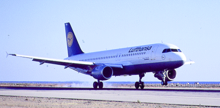
However, scheduled flights will initially be covered by A319s and A321s, which already have a dual GPS installation, while its A320s are undergoing a retrofit programme. Lufthansa's long haul A340s and 747-400s are being equipped to provide crews with more available diversion airfields when overflying Russia on routes to the Far East.
The GPS landing system works by programming the aircraft's flight management system (FMS)with a series of waypoints defining the standard approach to a given runway. During the autopilot-coupled approach the FMS then compares the data with actual position coordinates supplied by the dual GPS, and guides the aircraft.
As no ground station is available to provide a differential correction to the GPS data, the system is only capable of performing non-precision approaches, and the pilot must take over manual control of the aircraft during final approach and perform the landing.
Source: Flight International