


Traffic crossing the North Atlantic is predicted to increase by 50% over the next decade, and the region already has the busiest oceanic airspace in the world by far. The technological response to address this air traffic management (ATM) capacity challenge is a world first.
Traffic crossing the North Atlantic is predicted to increase by 50% over the next decade, and the region already has the busiest oceanic airspace in the world by far. The technological response to address this air traffic management (ATM) capacity challenge is a world first.
New oceanic surveillance technology, designed to enable increased traffic to be managed safely, began live trials in on 29 March. The trial involves Nav Canada in the Gander Oceanic Flight Information Region (FIR) and the UK’s NATS in the Shanwick FIR, the contiguous sectors that carry very nearly all the traffic that flies both ways between North America/Central America and Europe/Middle East.
Instead of using radar to conduct traffic surveillance and separation, or continuing with traditional oceanic procedural air traffic control, the air navigation service providers (ANSPs) use satellite-relayed automatic dependent surveillance – broadcast (ADS-B) position reports, which are transmitted by each aircraft every 4-8sec. The early results – still under analysis – are looking positive, conferring safety validation for smaller separation distances, and a hugely increased probability that aircraft will be able to be cleared to fly at their chosen speed and best height.
Until now, aircraft flying between North America and Europe have always been invisible to air traffic control once they are more than about 350km off the coast on either side, because at that distance from radar antennae they disappear over the radar horizon. Air traffic control officers (ATCOs), however, still know approximately where each aircraft is because they report their position, height and a time estimate for the next reporting point every 14min or so. This is done via ADS-C (ADS – contract) via a FANS (future air navigation systems) datalink. It works safely because aircraft are painstakingly released into their pre-cleared, one-way oceanic tracks at specific heights, time intervals, and speeds, so they maintain separation vertically and horizontally.
That old system is an enhanced version of a well-tried ATM methodology known as procedural control, and most of the world will continue to control oceanic air traffic procedurally for some years yet. Only 30% of the earth’s surface has radar coverage enabling aircraft surveillance for ATM purposes, and ADS-B is increasingly also used to cover large wilderness areas in some countries like Australia. But at present they have ground-based – not satellite – data-link relay systems.

NATS
However, the North Atlantic initiative exploits the new Iridium NEXT constellation of low-Earth orbiting communications satellites – 66 primary satellites and nine orbiting spares, launched in batches by a series of SpaceX Falcon 9 flights in the two years running up to January 2019. Each satellite carries an ADS-B transceiver that relays aircraft ADS-B datalink signals to ATM units like Nav Canada’s Gander and NATS’ Prestwick Oceanic Centres. Aircraft-mounted ADS-B transmitters stream information about each aircraft’s position, height and much more every few seconds. This allows ATCOs to track the aircraft as if in real time, with a radar-like data-update rate of 8sec or less.
On 4 February this year US-headquartered communications technology company Aireon, which owns the ADS-B payloads hosted aboard the NEXT constellation and is responsible for setting up the satcom datalink network, was able to announce that its space-based air traffic surveillance system had been switched on. The company says its system could enable ATM traffic surveillance “anywhere on earth”.
NATS has had a 10% share in Aireon since 2018. As its chief executive officer Martin Rolfe says: “This is a transformational technology that will deliver the world’s first truly global air traffic control infrastructure, making flying even safer and more efficient. The North Atlantic is the busiest area of oceanic airspace in the world and the gateway to Europe, but its routes have now reached their limit of capacity with existing technology, so we are delighted now to have a safe way to meet the ever-growing demand.”
Less than two months after switch-on, on 28 March, surveillance trials involving Nav Canada and NATS began on the busy North Atlantic (NAT) routes that each manages across their contiguous sectors of responsibility. The trials are endorsed by the International Civil Aviation Organisation.
According to precise measurement of performance, comparing westbound NAT traffic between 28 March and 31 July 2018 with the same period this year, traffic in 2019 was 2.2% higher, and flights assigned their requested trajectory increased by 6 percentage points to 66% – and this is rising to 90% now, according to oceanic sector controllers. Meanwhile nearly 3,000 fewer flights were given levels lower than requested, 2,300 fewer were re-routed, and 108 fewer were required to adjust their speed.
For perspective, the number of flights passing through NATS-controlled Shanwick OCA in 2018 was just over 500,000.
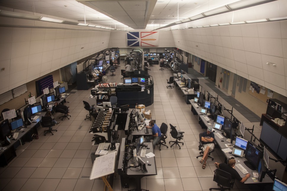
Nav Canada’s Gander area control centre
Nav Canada
In the first 107 days of the trial involving OWAFS (operations without fixed assigned speed), 31,689 additional flights were given permission to “resume normal speed” – which means they can adopt optimum speed. At present these clearances are still issued manually by ATCOs where they see opportunities and where workload permits, but NATS says they will be automated by in the first quarter of 2020. ATCO-flightcrew communications are normally by controller-pilot data-link communications (CPDLC) using keyboard-generated messages.
NATS head of strategic oceanic engagement Andy Smith says: “We’re seeing the beginning of the end of the Organised Track Structure (OTS). The OTS was introduced decades ago, itself designed to add additional oceanic capacity with a series of set routes designated each day, taking into account the location of the jet stream, to permit aircraft to efficiently cross the North Atlantic.”
Of course crews will continue to choose the shortest routes that will minimise headwinds or take advantage of tailwinds, but effectively the NAT area will gradually become free-routing airspace. Smith says: “Being able to reduce separation standards and offer greater flexibility on routes, speeds and levels means 62% of traffic now doesn’t need to use the OTS at all, compared with 50% in 2015. That’s a trend we will now see accelerate as we continue to unlock all of the service improvements available to us through Aireon and our deployment of our new standards. Over the coming years, we estimate that 90% of airspace users will be assigned their requested trajectories, something that will support the progressive reduction and eventual removal of the OTS.”
Annual fuel savings on the North Atlantic at this stage of the trial are expected to be around 38,800 tonnes. As experience with the system increases, and if validation analyses continue to prove margins are safe, further improvements may be gained.
The possession of radar-like surveillance capability improves safety as well as efficiency, and allows for much more precise monitoring, recording and analysis of traffic behaviour. This in turn enables better risk identification and potential improvements in best practice. Previously, if an aircraft began to deviate from its cleared track just after a position report because clearance details were misunderstood or entered incorrectly, it could take up to 15 minutes before ATC got a position update that revealed the error.

ADS-B transceivers are flying as hosted payloads aboard Iridium NEXT communications satellites
Iridium
Another benefit of an ADS-B datalink is that it goes beyond providing aircraft position and speed. It can also indicate the crew’s intention by reporting pilot input to the flight control panel to change the aircraft’s flight level or heading. So if, for example, the intended flight level selected is incorrect according to the aircraft’s clearance, the ATCO will receive a warning before the error has been actuated.
Controllers on the Shanwick Oceanic sector sit at a HMI (human/machine interface) display which, to the unpractised eye, looks almost identical to those used by controllers working the Scottish domestic sectors in the same operations room at Prestwick Centre – except the latter are using secondary radar surveillance rather than ADS-B reports. In just the same way, the oceanic controllers watch contacts – accompanied by “data blocks” identifying each flight and its intentions – shift slightly with each update.
As Smith explains, the oceanic controllers are assisted by automation, and therefore do not have to monitor every aircraft all the time, enabling them to safely monitor larger numbers than they were previously able to do. Clicking on any contact will provide information on the 12 closest aircraft. There is automatic warning to the controller of any emerging potential conflicts, and these are prioritised.
At work the oceanic controllers are quiet most of the time, occasionally checking a particular contact that looks clear of traffic to see if it could be relieved of any restrictions to its clearance. If it is clear, the controller taps into the datalink keyboard “resume normal speed”, or passes it a clearance to the flight’s requested flight level if it was being held down.
The ability to study traffic behaviour in detail – and record it for analysis – also throws up interesting facts. For example, airlines are permitted, without requiring individual clearance, to adopt strategic lateral offset procedures (SLOP), which means intentionally paralleling the cleared track either 1nm or 2nm to the right. This variation reduces traffic collision risk when many aircraft are flying the same cleared track. ADS-B surveillance has discovered that different airlines seem to have different attitudes toward SLOP, evidenced by different patterns in their crews’ decisions whether to use it, when to use it, and how often. The decision-making logic has not yet been pursued, but perhaps it can be, says NATS.
The live trial in Gander and Shanwick Oceanic is currently ongoing, but all the signs are it is working to specification or beyond. Back in February 2019 Aireon chief executive Don Thoma was able to boast that “for the first time in history, we can surveil all ADS-B-equipped aircraft anywhere on Earth”. Not all the world’s ANSPs are ready for it yet, but those that are ready – apart from Nav Canada and NATS – include the Irish Aviation Authority, Italy’s Enav and Denmark’s Naviair.
Meanwhile the European Aviation Safety Agency (EASA) is in the process of certificating the provision – by Aireon – of space-based surveillance over the whole continent. This surveillance data would be supplied to ANSPs. Thoma touts Aireon’s product as “global surveillance as a service”. That will be another first: the provision of surveillance data to ANSPs by an organisation that is neither an ANSP nor the military.

Controllers can have radar-like view of even the most remote airspace
Dan Thisdell/Flightglobal
FAA’S APPROACH
South of Gander Oceanic is the New York Oceanic FIR, a responsibility of the US Federal Aviation Administration. It does not have the same capabilities for reduced separation that Nav Canada and NATS offer in their oceanic FIRs and uses a system similar to that Nav Canada and NATS have just replaced, based on ADS-C relayed via FANS datalinks.
The FAA is thoroughly familiar with the use of ground-based ADS-B for surveillance, but has not deployed it in oceanic areas. The FAA’s Capital Investment Plan sets out the agency’s plans to deploy ground-network-based ADS-B surveillance gradually, replacing secondary surveillance radar over land and in coastal areas beginning in 2020. The FAA already uses it extensively in the Gulf of Mexico for surveillance of low level oil-support helicopter operations.
But the agency’s intentions in Oceanic areas – like the New York Oceanic FIR – are not fully defined. It does say, however: “The Reduced Oceanic Separation (ROS) – Advanced Surveillance Enhanced Procedural Separation (ASEPS) program will re-examine current limitations to reducing oceanic separation standards by evaluating improved surveillance capabilities, including Space-Based ADS-B and enhanced ADS-C with a faster update rate than available today [a 3.2min update rate is planned]. This investment will increase the precision of information used for aircraft separation resulting in safer and more efficient operations. The program is working towards a financial investment decision.”
Inmarsat, however, in a statement released in July, said: “The United States Government and Accountability Office (GAO) recently published a report confirming that the FAA has committed to use enhanced Automatic Dependent Surveillance-Contract (ADS-C) technology to achieve reduced distances between aircraft, called minimum separation standards, in US oceanic airspace as part of its commitment to implement new international standards by 2022.”
The satcoms company says the ADS-C will be powered by its SB-S and Classic Aero services, and adds: “The decision by the FAA, which regulates the largest aviation market in the world, was driven by an in-depth analysis of the cost and benefits of both ADS-C and space-based ADS-B technologies.”
The GAO report goes further, says Joseph Teixeira, Inmarsat’s vice-president for aviation safety and cyber-security. “The FAA decided to proceed with enhanced ADS-C in the near term because the efficiency benefits to airspace users exceeded the costs of more frequent location reporting and air traffic control system upgrades by 2 to 1. In contrast, the FAA determined that the costs of using space-based ADS-B in US oceanic airspace outweigh the efficiency benefits by 6 to 1.”
The FAA has certainly not ruled out space-based ADS-B surveillance in the future, but observes: “Operational challenges to using space-based ADS-B to manage air traffic in US oceanic airspace have not yet been resolved. The FAA plans to continue studying the potential uses for space-based ADS-B in US airspace to determine if benefits can outweigh the costs.”
But when NATS was reviewing enhanced ADS-C as an upgrade option it found that, while it provided the potential for smaller separations than the non-enhanced variant, safety improvement was limited by the fact that an ADS-C report takes minutes to download – whereas ADS-B takes less than a second. This ADS-C message latency degrades real-time surveillance accuracy compared with ADS-B.
So, while the FAA was doing its cost-benefit analysis on potential oceanic surveillance upgrades, it seems likely that the agency may have been influenced by the simple fact of the lower traffic density in its oceanic airspace. On both the USA’s Atlantic and Pacific shores the airspace is busy, but much less so than the North Atlantic sectors that Nav Canada and the UK look after.
Although potential problems may arise from this difference in separation standards, they can be mitigated. For example flights from most US east coast airports to Europe start out in New York Oceanic airspace and then enter the North Atlantic areas operated by Nav Canada and NATS, where separations can be reduced en route. But on their westbound return, if they operated on reduced-separation North Atlantic tracks, the potential exists for some of them to exit too close together to be compatible with New York Oceanic’s larger separation requirement. If so, during the crossing some flights may have to be given less-than-optimal tracks or speeds to ensure this is avoided.

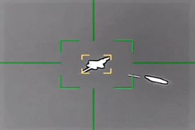
Aircraft approaching New York airspace destinations such as LaGuardia will move off of the ADS-B system
Justin Lane/EPA-EFE/Shutterstock