


Estonia’s air traffic control service is looking to reinforce its navigation systems to offer an alternative to GPS owing to recent jamming of the satellite signal.
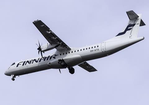
The situation has prompted Finnair to suspend temporarily its daily services to Tartu from 29 April.
Finnair has been operating the route with ATR 72 turboprops.
But it says the approach patterns it uses for Tartu are based on GPS, and that – owing to interference – it is halting the flights until 31 May.
The airline is waiting for an alternative approach method which is independent of GPS before it restores the service.
Two Finnair flights have recently been forced to divert back to Helsinki after encountering GPS interference in the vicinity of Tartu, which lies about 50km west of the Russian border.
While the airline has not specified the flights involved, surveillance data indicates its AY1045 service was affected on both 25 and 26 April.
The carrier says such interference is “quite common in the area”.
“Flight safety is always our top priority and, as the approach to Tartu currently requires a GPS signal, we cannot fly there in the event of GPS interference,” says director of operations Jari Paajanen.
“Our pilots are well aware of the issue, and the aircraft have other navigation systems that can be used when the GPS system is unserviceable.”
Estonian air navigation service EANS disclosed last month that it was updating its ground-based systems to provide additional distance measurement capability to crews.
This included installing five new range-finding systems across the country to serve as an alternative reference to GPS.
“In terms of flight safety, this is an important step which creates the opportunity to choose between different alternatives,” says EANS head Ivar Vark.
The supplementary equipment – installed in Laane, Laane-Viru, Saare, Jogeva and Viljandi – enables the aircraft to calculate its location by considering distance measurements from different locations.
These systems, however, are intended mainly to support overflights and aircraft operating above 3,000m (9,800ft).
“Considering the new situation, EANS has started to look for additional ways to support airlines at lower altitudes,” says Tartu airport’s operator.
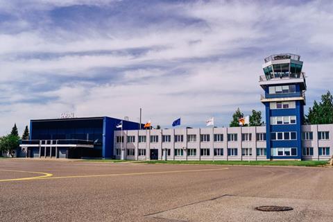
Tartu has a single runway, designated 08/26, and the operator states that it has an ILS for precision landing guidance in one direction. “At the moment there is a concern about how to support carriers flying below [3,000m],” it adds.